If you’ve ever wanted to see how the Coquitlam neighbourhood you grew up in changed over the years, take your eyes to the new online exhibit created this month by city staff.
Bird’s Eye View: Coquitlam From Above — a display built by archivist Emily Lonie— captures aerial images snapped between 1963 and 1991 that show the landscape evolution.
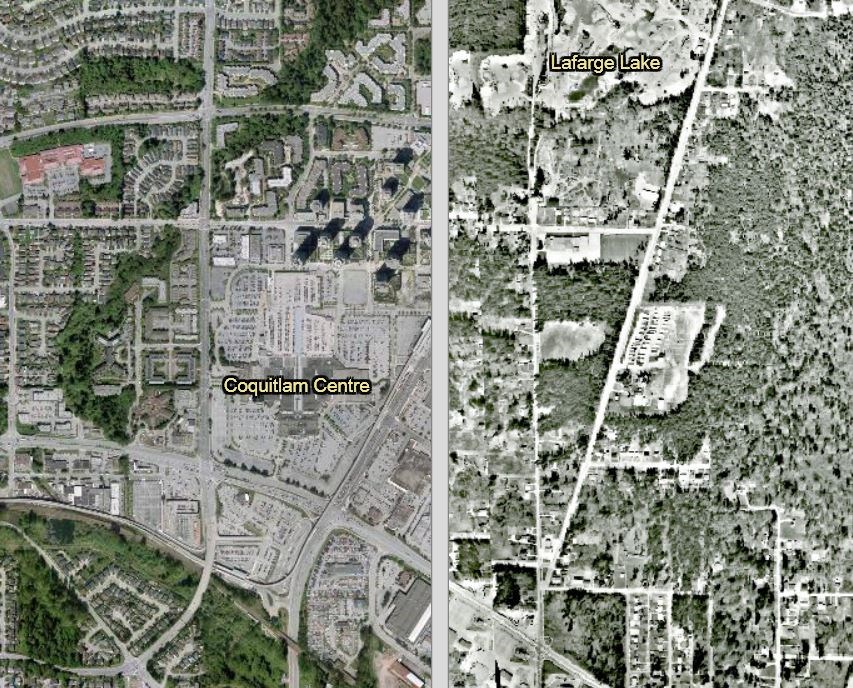
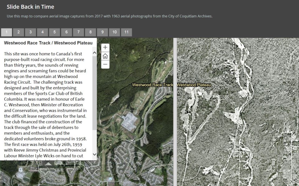
Using a unique tool, viewers can also slide between the pictures to see how neighbourhoods from the south — i.e., Maillardville and Fraser Mills — to the north — i.e., Westwood Plateau and Burke Mountain — have shifted with the development.
Essentially, viewers can go back in time to watch how homes and businesses have built up and taken over forests.
While the mountainous scenes to the north have experienced the most growth, little has changed in Central Coquitlam over the past half century, Lonie said.
“We’ve managed to retain much of the green space especially north of Como Lake [Avenue] and the golf course [on Austin Avenue],” she noted.
Significant landmarks like Laval Square, Mundy Park and Coquitlam Centre mall also haven’t changed much, which makes them good locators when identifying neighbourhoods in transition, she said.
Still, shorelines have transformed the topography in some areas.
Lonie approached Mona Rudolph and Mike Esovoloff, with the city’s mapping and drafting section, two years ago with the aim to give more exposure to the digitized 1963 aerial images, currently used by the planning and engineering departments.
“They jumped on board right away,” she said.
The pair tapped into the city’s Geographical Information System technology to map the 1963 photos, snapped by the provincial government, to mesh with Coquitlam pictures from 2017.
Meanwhile, the set of 1969 aerial photos will fall into the public domain on Jan. 1, 2019, “and we hope to digitize them over time to add to our archives,” Lonie said.
The exhibit will be of special interest to heritage consultants — especially those who want to see a garage or roof style from an earlier era, for example — history students “or anyone else who wants to see how Coquitlam developed in time.”
Visit coquitlam.ca/birdseye to view the aerial photos of Coquitlam.
jcleugh@tricitynews.com
••••••••
ON THE MOVE
Coquitlam’s archives department is moving to a new location in the new year.
As reported in last week’s The Tri-City News, archives will be sited in the City Centre branch of the Coquitlam Public Library building.
The online search portal, Quest, will still be available via searcharchives.coquitlam.ca.


