East Burke Mountain
Rating: moderate (but with tricky route finding)
Time needed: 4-6 hours.
Length: 12 km
Elevation gain: 750 m
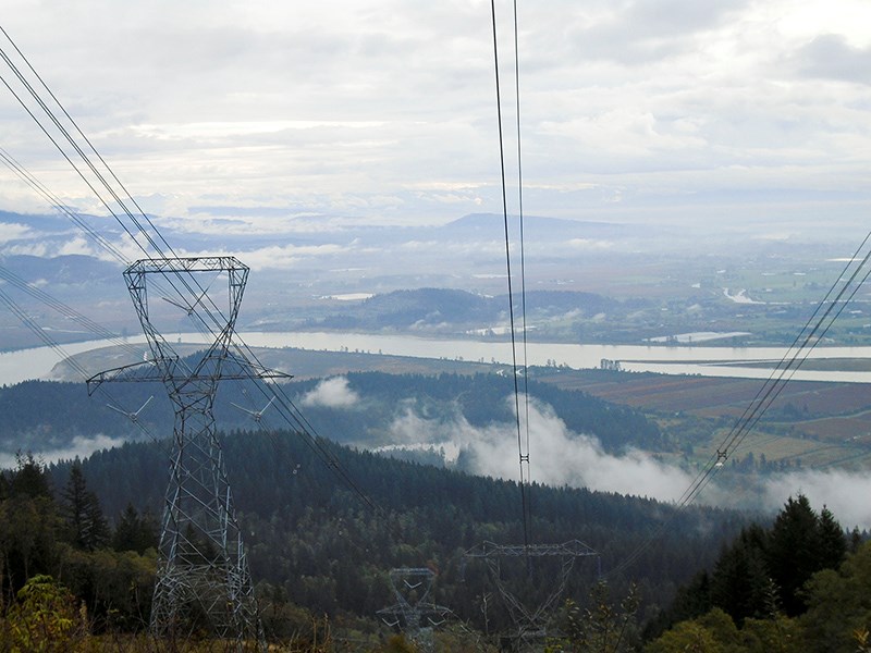
This hike explores the labyrinth of trails and tracks on the east side of Burke Mountain, and takes in an open viewpoint that overlooks Minnekhada Regional Park, the Pitt River and Mount Baker.
The route provides a sample of the types of trail that can be encountered on Burke Mountain — everything from BC Hydro service roads to steep mountain bike trails. Be aware you may encounter fast-moving mountain bikers, so be ready to step aside to allow their safe passage.
From the entrance of the Gun Club on Harper Road, head down to Conifer Drive, where you will take the first mountain bike trail that heads up to the left (Fluid). Turn right when you emerge on the gravel road and then carry on straight along the road for about 700 m, keeping an eye out for a small track heading off to the right. The track is quite wide to start but becomes more overgrown and narrow as you progress. Just before emerging onto a service road, there will be some steep sections as the trail crosses a creek.
The rocky service road provides great views looking east that improve as you ascend up to the main service road at the top. Turn right when you reach this and then right again at the next junction. As this small spur road curves to the left, look out for an indistinct trail heading off up the slopes. This is the Sandinista mountain bike trail.
Shortly after entering the woods, you will come across an elaborate mountain bike jump, confirming that you’re on the right trail. Follow Sandinista up to the road, turn right and, shortly afterwards, right again onto the Gunners Trail.
This trail becomes swampy at one point, and then narrows and becomes more indistinct before emerging onto the Village Lake Trail. Heading east from here takes you to Munro and Dennett Lakes, but our walk heads west for a kilometre until you hit the gravel road again.
Follow the road down to the first big curve and then head down the mountain bike trail (Upper Triple Crown) that leaves the road from that point. Turn left at the road spur and then at the T-junction, head steeply down the mountain bike trail on the far side of the junction (Lower Triple Crown). When you hit the gravel road again turn right and follow it back to the start point.
--Steve Chapman is a Coquitlam Search and Rescue volunteer, a member of the Burke Mountain Naturalists and the creator behind a detailed new map of Tri-City trails. More info on safe hiking: www.coquitlam-sar.bc.ca.