Like any dad, Geoff Hunt always wants to keep his family to be safe.
But his concerns about flooding in the unlikely event an earthquake destroys the Coquitlam dam has him worried about his neighbours and local schools, too.
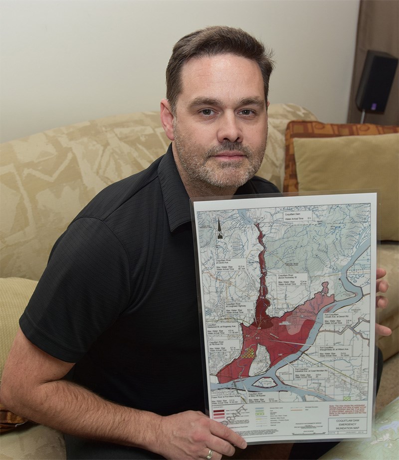
Earlier this month, he obtained a flood inundation map from BC Hydro with some concerning news:
His home on Harwood Avenue in Coquitlam's New Horizons neighbourhood would be under water should the dam be knocked out by a quake — and his family would have just 48 minutes or less to get to higher ground.
”It’s a very short amount of time, you can imagine, to get people out of the area," he said.
Outside his home just a block from the Coquitlam River, Hunt imagines what it would be like to try to warn neighbours, many of whom probably don’t even know there’s a dam upstream, in the event of a severe quake.
And it wouldn’t take long for the water from the Coquitlam reservoir to send trees, gravel, soil and rocks down the Coquitlam river taking out homes, schools, roads, bridges in its wake.
Lougheed Highway, Mary Hill Bypass and the approaches to the Port Mann Bridge would all be under water.
It’s an unlikely scenario because the dam was rebuilt 10 years ago to withstand a major earthquake but Hunt is still concerned about the lack of awareness in his community about the potential deluge.
That's why, last year, he began his quest for information by emailing the cities and BC Hydro. He even took a tour of the Coquitlam watershed and the size of the reservoir — used to supply water and power to the region — motivated him to do more to ensure Coquitlam and Port Coquitlam residents are prepared and know to evacuate to higher ground in case of a severe quake.
Hunt obtained his copy of the Coquitlam Dam emergency inundation map produced by BC Hydro at a meeting of civic officials. Now, he wants assurances that it will be placed on city websites and emergency plans are updated to include evacuation plans.
Hunt doesn’t want to scare people, he just believes the more information they have, the better prepared they will be.
“Emergency Preparedness Week comes and goes," he said, "and no one mentions that there’s a dam there.”
See related story for more information.


