Hundreds of thousands of Canadians are unknowingly buying homes and relying on infrastructure in areas at high risk of bursting rivers, extreme temperatures and rising seas, warns a new report.
In what the researchers are claiming is the largest study to date on the impacts of climate change on the country’s infrastructure, the Canadian Institute for Climate Choices (CICC) says Canada is walking blindingly toward a multi-billion-dollar bill.
“You get these municipalities that are kind of caught between the land and the sea, where they face a higher risk of flooding because there's so much valuable infrastructure and so many homes crammed in there,” says Deborah Harford, former executive director of SFU’s Adaptation to Climate Change Team and an expert consultant for CICC.
The future costs of flooding, extreme heat and more rain are projected to extend beyond homes and businesses. Up to half of Canada’s growth over the past 45 years has come from investments in public infrastructure, including everything from roads, water pipes and bridges to the electric grid, phone lines and broadband Internet. Much of that is falling into disrepair, or for many Indigenous communities, never existed in the first place.
To bring infrastructure up to an acceptable standard would require a $250-billion investment, estimate the authors.
But wait too long, and the coming decades of temperature extremes and flooding would hike the yearly bill by billions of dollars more.
PRIVATE HOMES AT HIGH RISK
There are huge gaps in our understanding of how such catastrophic damage will play out.
We do know people’s homes are expected to bear the brunt of the risk. Of Canada’s total infrastructure value, almost 85 per cent is found in privately owned homes, according to Statistics Canada.
Current national flood risk maps, which are used to underwrite insurance, inform home buyers and help plan new infrastructure, are 20 to 25 years out of date, according to the Insurance Bureau of Canada.
That means at least half a million buildings at risk of flooding are not identified on current government flood maps, and “virtually none of them show how climate change may affect the future risk of flooding,” notes the Under Water study.
The Insurance Bureau of Canada is already in the process of transforming itself from an organization largely there to insure against fire, to one that's increasingly focused on flooding, says Harford. But only a fraction of Canadian property owners understand the risk they are facing. A 2016 survey showed that roughly 45 per cent of Canadian homeowners have insurance that will pay for flood damage, when in fact, only 10 to 15 per cent are actually covered.
That risk is not shared equally across the country.
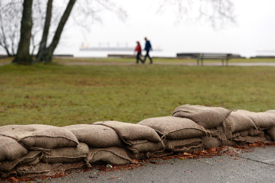
In B.C., the number of homes at risk of storm surge is projected to climb 44 per cent by the end of the century to nearly 70,000. That’s more than any other province in the country.
Metro Vancouver is a hotspot for such risk. Part of that is because of high property values — roughly $30 billion in home and building value sits within one metre of current sea level. But many municipalities in the region also face twin pressures from rising seas and a network of massive rivers.
“We have our airports, we have our port, we have all of, you know, this extremely high-value infrastructure in Vancouver; we have huge areas like Richmond and Delta and Surrey, that are exposed both to sea level rise and the Fraser River,” says Harford.
Between 2070 and 2100, Metro Vancouver’s annual flood damages are expected to climb to $510 million annually, a 17-fold increase, under a low-emissions scenario; and up to $820 million annually, 27 times the current value, under a high-emissions scenario.
That’s all expected to filter down to individual homeowners. Fifty years from now, average individual property damage is projected to hit $4,400 per year in Metro Vancouver, more than seven times today’s cost.
“In hot real estate markets such as Vancouver and Toronto, this means that property buyers — from individual homeowners to commercial real estate investors — are likely paying too much for homes and buildings whose value will drop when their flood risk becomes apparent,” warns the report.
Past research has found all levels of government have fallen short. In a February study handing out flood-readiness report cards, provinces across the country got an average C rating for their work; the City of Vancouver, meanwhile, received a C- after falling short on protecting critical infrastructure, land use planning and safeguarding public health.
But experts say without updated flood maps, all three levels of government and the private sector won’t have a common template to act.
In 2020, the federal government launched a task force to examine the viability of a low-cost national flood insurance program.
And in last month’s election, the Liberal Party promised to accelerate efforts to update national flood maps.
Until that happens, huge risks are going undisclosed to property buyers, mortgage lenders and mortgage-backed security holders — a risk that extends to the destructive potential of wildfire, heat and permafrost.
Once those risks to climate-induced flooding are updated, the real estate market is expected to see a correction, and property owners will likely face a confluence of rising insurance rates, zero coverage and sinking property values, says the Under Water study.
The report warns that as property values in affected areas decrease, home and business owners would likely haemorrhage wealth and default on their loans. Scale that up and economic consequences could ripple through consumer spending, lending and credit, and wholesale economic growth.
“There's a kind of a political fear around that, around the sudden perception that suddenly your house is exposed in a way that couldn't have been seen before,” says Harford.
PREVENTING FLOOD DAMAGE
When it comes to coastal flooding, B.C. is projected to suffer 68 per cent ($820 million) of Canada’s annual damage costs by 2070.
But by deploying some combination of sea walls, elevated buildings and beach nourishment, the report’s authors say the province could drop that bill by 90 per cent down to $60 million annually.
The report did not consider other adaptation measures, such as green infrastructure and the restoration of coastal wetlands, both of which can slow flooding from high-intensity rain and rising seas.
For communities along inland waterways, the report went one step further, contemplating and costing a strategic retreat. For buildings and infrastructure facing the highest risk of flooding from inland rivers, the authors calculated government buy-back programs would save money in the long-term. Early retreat, they said, means homeowners would get a fair market value before it’s too late.
CLIMATE-PROOF RAIL, ROADS AND ELECTRICITY
The cost to fix roads, rail and electric grids could be substantially reduced if government and private money are proactively invested to repave roadways, deploy temperature sensors and update electrical infrastructure with more resilient materials.
Without such action, by mid-century, extreme temperatures and rainfall could lead to a 20 per cent spike in annual spending to fix damaged roads, say the report's authors. That’s in addition to the $20 billion already spent every year on Canadian roads.
“These costs will hurt the bottom line of municipal governments — which are responsible for most roads in Canada — and will ultimately impact residents through higher taxes, poor road conditions, and delays,” notes the report.
Such delays could potentially lead to massive supply chain disruptions as trucks and trains are held up. Alberta, Quebec and Ontario, which have the most extensive road networks in Canada, are projected to be hit hardest.
That is, unless, changes are made.
Altering asphalt mixes on roads so they can handle extreme summer heat, increased precipitation and more frequent freezing and thawing could reduce rising climate-related costs by up to 98 per cent by 2070.
Track temperature sensors allow rail operators to fine-tune speed orders for trains. Deploy them across the country’s rail network and operators would have a tool to avoid blanket orders, and reduce delay costs by roughly 80 per cent by the end of the century, the report says.
Electric grids, meanwhile, are vulnerable to extreme wind, ice storms and heat, all expected to get worse as climate change disrupts historic weather patterns.
To avoid rolling outages or blackouts on hot days, the report suggests building transformers and transmission lines that can withstand extreme heat.
Bolster wood electricity polls with steel reinforcements, and you can delay replacement as they rot under increased precipitation and heat, suggest the authors.
The report says that despite the clear benefits of investing early in infrastructure, progress has been limited, and private infrastructure owners have largely ignored long-term planning in favour of “short-term budgets and balance sheets.”
That, says Harford, needs to change.
“We’ve got time, but we don’t have time to do nothing.”
Stefan Labbé is a solutions journalist. That means he covers how people are responding to problems linked to climate change — from housing to energy and everything in between. Have a story idea? Get in touch. Email [email protected].


