HIKE OF THE WEEK
Widgeon Falls
Rating: moderate
Time needed: 4-6 hours.
Length: 15 km (9 km paddling, 6 km hiking)
Elevation gain: 330 m
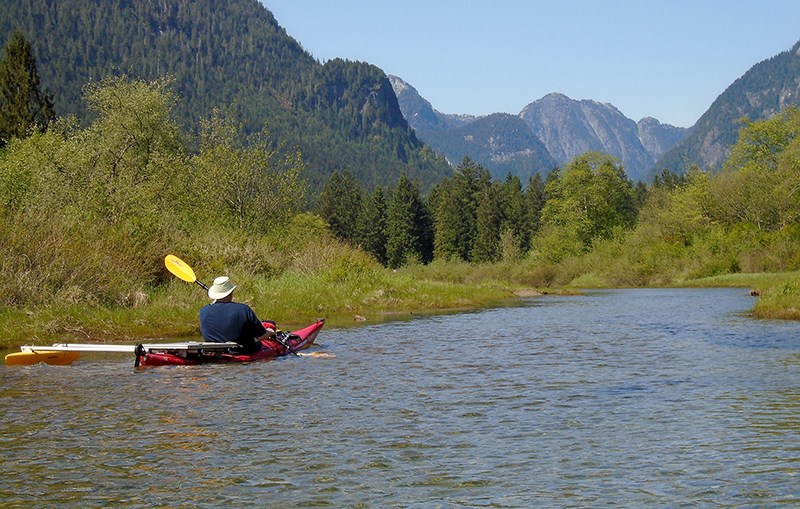
Reaching Widgeon Falls requires both a paddle and hiking boots.
Expect the paddle to take 60 to 90 minutes (one way) and the hike to take two to three hours.
Both portions of this mini expedition are scenically rewarding, making this one of the classic outings in Metro Vancouver.
For those wanting to make this an even more leisurely experience, the Widgeon Creek campsite can be used to turn this into an easy overnighter. The paddling portion can be done by either kayak or canoe. For those without their own boats, canoes can be rented from the boat launch at Grant Narrows (in Pitt Meadows).
From the boat launch at Grant Narrows, paddle northwest across the Pitt River to the gap on the north side of Siwash Island. Note that this stretch of water can experience fast currents, and when the wind picks up in the afternoons, the water can be choppy.
After crossing the open water, you will enter into the mouth of Widgeon Creek, which is quite wide at this point. Keep right at the north end of the island and then keep following the channel until you reach a fork. Turn left at the fork and keep following this creek channel until you reach the obvious site of the campground.
As you progress along the creek, it will get progressively narrower — so pick your route wisely to avoid being grounded.
Also note that Pitt Lake (and connected waters) constitute the largest freshwater tidal lake in North America, so expect the water levels to fluctuate during the day.
From the back of the campground, pick up the track that heads north (right). Follow this for about 1.5 km as you ascend easily to a trail junction that is signposted to Widgeon Falls in both directions. Take the path that heads off to the right away from the main track.
The path meanders for about 700 m until you reach another trail junction for the old trail. Do not take the old trail as this has structures that have now rotted and are dangerous. The bridges on the new trail have been put in by volunteers from the Pinecone Burke Stewards, working in conjunction with BC Parks. At the T-junction, turn right and follow the trail all the way down to Widgeon Falls.
The falls are a nice place for a picnic and are usually at their best after heavy rain or during high melt-off days in spring.
Be careful on the rocky slabs near the edge as a slip here would have serious consequences.
For the return route, retrace to the T-junction, continuing straight on there until you meet the main track. Follow this south (left) all the way down to the campground and your boat.
Expect an exciting crossing to Grant Narrows on a hot sunny afternoon.
--Steve Chapman is a Coquitlam Search and Rescue volunteer, a member of the Burke Mountain Naturalists and the creator behind a detailed new map of Tri-City trails. More info on safe hiking: www.coquitlam-sar.bc.ca.


