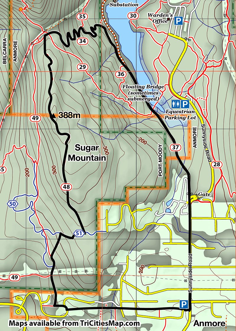
HIKE OF THE WEEK
Sugar Mountain Loop
Rating: moderate
Time needed: 3-4 hours
Length: 8.5 km
Elevation gain: 400 m
Sugar Mountain is often overlooked by Tri-City hikers exploring the more popular areas around Buntzen Lake.
Situated between Sasamat Lake and the village of Anmore, it can be considered to be a southern extension of the Diez Vistas ridge but offering easier and quieter trails than its northern companion. This hike takes in a pleasant trip over the crest of Sugar Mountain, starting and finishing at the small parking lot at Anmore village hall, near the fire station.
From the parking lot, head west on the urban trail that skirts behind the gardens of the large houses. After crossing a couple of roads, you will cross over a small stream, after which an up and down will bring you out onto Crystal Creek Drive.
Following the trail over the other side for about 100 m, take the next path that branches to the right. This will soon bring you out at an intersection with a wide track. Going left would bring you out at Sasamat lake but this hike takes the northern direction upwards.
After about 200 m, look out for a small trail that heads off to the right. The entrance to this is disguised by a large rock slab. Follow this upwards to a T-junction and then continue upwards on the Little Bear Trail for about 200 m. At the crest of the ridge, take the branch that heads left (north), and continue following this trail along the crest of Sugar Mountain.
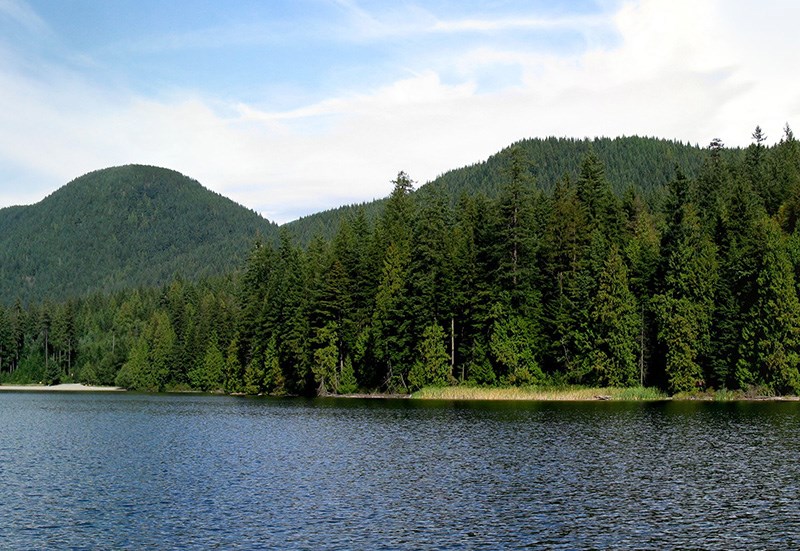
The Sugar Mountain Ridge Trail is a really pleasant hike, meandering through fairly open forest along a well-marked, single-track path. Near the high point, look out for a short trail to a viewpoint on your left, which provides views through the trees down to Sasamat Lake and Indian Arm.
After a few steep downhill sections, the trail will bring you out onto the main trail that passes through the saddle at the southern end of the Diez Vistas Ridge. Follow this northeast passing by the crossroads for the Diez Vistas Trail, before starting to descend on switchbacks.
Halfway down, there will be a trail junction. Take the right fork, following the trail all the way down to the main unpaved road on the west side of Buntzen Lake. The unpaved road passes by the floating bridge before bringing you out at the park gate on Sunnyside Road.
Use the sidewalk on the left side of Sunnyside Road to return to the parking lot.
--Steve Chapman is a Coquitlam Search and Rescue volunteer, a member of the Burke Mountain Naturalists and the creator behind a detailed new map of Tri-City trails. More info on safe hiking: www.coquitlam-sar.bc.ca.