Hike of the Week
Snowshoeing to Cypress Lake
Rating: moderate
Time needed: 5-6 hours.
Length: 10 km (13.5 km with extension)
Elevation gain: 560 m (740 m with extension)
This hike makes for a pleasant outing at any time of the year but when the snow level is down to 700 m, it provides a great opportunity to use your snowshoes in the Tri-Cities.
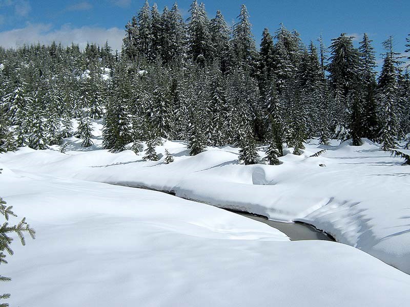
The end destination is Cypress Lake, a picturesque spot high above Westwood Plateau. There is an optional extension that adds more fun snowshoeing and also takes in a fine viewpoint that looks out towards downtown Vancouver.
Start on Eagle Mountain Drive at the junction with the gas plant service road. Follow this road up for about 400 m and then pass through a gate on your left, continuing on the track that continues beyond. This track is a key landmark on Westwood Plateau as trails radiate from it along its entire length, some going all the way to Buntzen Lake.
Follow the track over a bridge and upwards for about 1 km. Just before a bend, where the track crosses Noons Creek, you will see a distinct boulder strewn mountain bike trail (called “Dentist”) heading up on your right. Follow this up for about a kilometre, keeping to the main uphill path when confronted with trail choices.
“Dentist” brings you out onto another service road. Turn right and then almost immediately look out for another mountain bike trail heading up on your left (“Four Lost Souls”). Follow this upwards, passing insane mountain bike jumps, until you emerge on yet another track. In snow, the trail may be tricky to follow but the wooden jump structures are a good clue that you’re still on track.
If the snow line is low enough, then this is a good place to put on your snowshoes, as from now on, the route follows easy angled tracks that are ideal for snowshoeing when there’s enough snow. Turn left at the track and follow it over a bridge to a T-junction with another track. Turn right here and continue upwards to another T-junction. Turn right and follow the track for about 1 km until you see another track on your left, which is the short spur that leads to Cypress Lake. The lake is a good spot to take lunch.
The easiest way back is to retrace your steps. If you accidentally stray onto the wrong trail, then you will eventually end up on the main lower track, where a turn to the southeast will take you back towards the start.
For an optional extension to the hike, go straight on at the first main T-junction (when returning from Cypress Lake), taking the west branch of the upper track.
Follow this for 1.7 km to a fork. The left fork brings you out to a really nice viewpoint that overlooks Mount Seymour, with Vancouver in the distance. Retrace back to the T-junction and turn right there for the way home.
--Steve Chapman is a Coquitlam Search and Rescue volunteer, a member of the Burke Mountain Naturalists and the creator behind a detailed new map of Tri-City trails. More info on safe hiking: www.coquitlam-sar.bc.ca.


