Hike of the Week
Crystal Falls and Bullet Dodger
Rating: moderate
Time Needed: 4-5 hours
Length: 9 km
Elevation gain: 500 m
Most people venturing to Crystal Falls take the easy riverside path from Shaughnessy Street.
This hike takes a much more interesting and challenging route via the mountain bike trail called Bullet Dodger, so named because it skirts the boundaries of the Port Coquitlam and District Hunting & Fishing Club at the end of Harper Road.
Be warned that the route to and from the falls has steep sections and there is a possibility of getting your feet wet at the Pritchett Creek crossing.
Start the hike at the end of Harper Road by the entrance to the gun club and immediately take the small trail on the left (called Garbage), which leaves the gravel road near the gate. This will eventually bring you out onto one of the BC Hydro service roads.
Turn left here, after which there is a fork almost immediately. The left branch is the Woodland Walk, which you will follow for just under 400 m to where you will see a trail heading down on the left; this is Bullet Dodger. Do not take the first trail on the left (about 200 m from the junction) as this dead-ends in the firing range.
Follow Bullet Dodger down steeply for about 2 km. The trail twists and turns and, for a while, follows the crest of a small ridge before emerging onto the Crystal Falls Trail near to the Coquitlam River at the bottom. Halfway down there is a fork and either branch will take you down. The right branch will bring you out right at the falls, while the left branch (recommended) is the more obvious route.
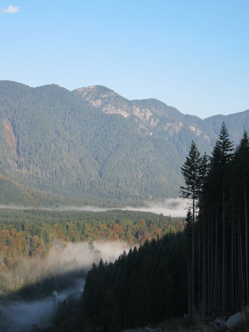
Follow the riverside path north to Crystal Falls. The falls are spectacular during high runoff but at these times it may be unsafe to cross Pritchett Creek. If this is the case, then it would be necessary to return the way you came. Even in modest water flow conditions, dry feet are not guaranteed.
After crossing the bottom of the falls, continue north along the river for about a kilometre, keeping an eye out for a trail coming down on the right.
This is the Coquitlam River Connector and will take you back up to the mid levels of the mountain.
Once you emerge on to the main service road, turn left and follow the road to near the end, where there are fine views out over the Coquitlam River Valley and over to Eagle Ridge. Retrace along the road crossing over Pritchett Creek again, this time more conveniently using a bridge.
About 200 m after the bridge, take the trail that forks right (Woodland Walk) and follow this all the way to where it rejoins the road. Follow the road back to the start, taking the right option at the T-junction.
--Steve Chapman is a Coquitlam Search and Rescue volunteer, a member of the Burke Mountain Naturalists and the creator behind a detailed new map of Tri-City trails. More info on safe hiking: www.coquitlam-sar.bc.ca.


