Diez Vistas South
Beach Lookout
Rating: Moderate
Time Needed: 3 to 4 hours
Length: 6.5 km
Elevation Gain: 550 m
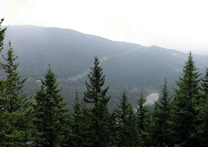
This hike is a much shorter and easier version of the well known Diez Vistas hike, taking in just the first viewpoint of that route. Rather than starting at Buntzen Lake, this route starts and finishes at Sasamat Lake, offering a more scenic and quieter alternative. The South Beach Lookout is not actually one of the official 10 viewpoints, but nevertheless offers nice views over to Eagle Ridge and down to the busy south beach of Buntzen Lake.
Start off at the main parking lot at Sasamat Lake (White Pine Beach) and take the trail that heads up into the bush at the back of the parking area. This trail continues up at an easy grade until it meets with a track that follows the path of the power lines. Continue north on this track, passing by the trail that heads up on the right. This will be your way down.
EASY TO FOLLOW
The track under the power lines is easy to follow as it heads up to the col between the Diez Vistas Ridge and Sugar Mountain. Watch out for bears and cougars in this area, as they are known to reside around this location. Carry on along this track until you hit the high point where you will intersect with the main Diez Vistas trail. Head north on this trail toward the higher ground.
The Diez Vistas trail heads up relatively gently to start with. After a viewpoint the trails begins to zig-zag up more steeply. At the first trail junction be sure to take the left option as right takes you on the old trail and tricky ground. At the second junction near to the top, head right after which it’s just a short distance to the South Beach Lookout.
BC HYDRO LINES
Follow the same way down to the trail junction at the bottom, continuing on a few yards past the track you ascended onto a second parallel track. Follow this southwest, and then south for about 1.5 km until you see a sign on your right for the Buntzen Ridge Trail, which is your way back to Sasamat Lake. Follow this down to the BC Hydro lines where you will turn left, and then shortly afterwards right, to take you back to the parking lot.
Steve Chapman is a Coquitlam Search and Rescue volunteer, a member of the Burke Mountain Naturalists and the creator behind a detailed map of Tri-City trials. More info: www.coquitlam-sar.bc.ca


