HIKE OF THE WEEK
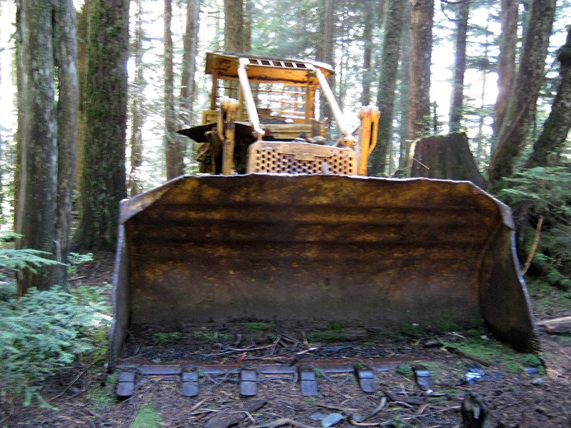
Burke Mountain Bulldozer
Rating: moderate
Time needed: 3-4 hours
Length: 7.5 km
Elevation gain: 500 m
For those not familiar with Burke Mountain, this hike provides an easy opportunity to explore its trails using some of the better marked tracks and trails.
The end objective of the hike is to reach an abandoned bulldozer on the South Slope Trail, a relic from logging operations decades ago. Those feeling more adventurous can continue up the South Slope Trail trail to the snow line and then don snowshoes to explore the higher subalpine meadows and lakes nearer to the top of Burke.
Start the hike at the end of Harper Road by the entrance to the gun club, passing by the yellow gate on the right and continuing up the gravel road. This gravel road is actually an extension of Harper Road and continues nearly all the way to the top of the mountain to the site of an old ski village.
The first turning to the left is a BC Hydro service road. Ignore this and take the next left, which is the continuation of Harper. Follow this upwards for about 2 km, gaining elevation along the way.
Halfway along this stretch, the road crosses the cut line for the power lines, providing views to the northwest.
Just before the first major hairpin on Harper Road, there is a green gate with a track heading off to the left. Following this track for about 200 m will take you over Pritchett Creek, after which look out for the South Slope Trail coming down on your right. Follow this upwards for about half a kilometRE to the obvious location of the Old Bulldozer. Just before the bulldozer, there is a split in the trail but as the two forks re-converge further up, it doesn’t really matter which one you take.
If you’re not exploring the upper reaches of the South Slope Trail, return via the same route to the track at the bottom. To vary things for the return hike, turn right here and continue along the track for about another half kilometre. At the next main junction, turn left onto the track that heads downhill. After 400 m, you will merge in with the Lower Coquitlam Lake View Trail, which you will follow south to the BC Hydro service road.
It should be noted that Pritchett Creek is crossed twice during this hike and, in times of high runoff, the crossing could be tricky or, very occasionally, dangerous.
Take the service road down for a short distance and then head left at the junction. This will take you back to Harper Road, where you will need to turn right to return to your starting point.
--Steve Chapman is a Coquitlam Search and Rescue volunteer, a member of the Burke Mountain Naturalists and the creator behind a detailed new map of Tri-City trails. More info on safe hiking: www.coquitlam-sar.bc.ca.


