Areas of Coquitlam, Port Coquitlam and Port Moody are under a snowfall warning as wet snow falls in higher elevations.
The cities are listed in an Environment Canada special weather statement.
According to the website, snowfall of up to about 5 cm is expected this afternoon in the following areas.
- Metro Vancouver - central including the City of Vancouver Burnaby and New Westminster
- Metro Vancouver - northeast including Coquitlam and Maple Ridge
- Metro Vancouver - southeast including Surrey and Langley
- Metro Vancouver - southwest including Richmond and Delta
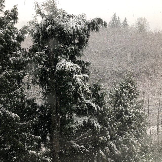
The wet snow is the result of a deepening Pacific low that will make its way across Washington State today, Dec. 21, 2020.
Heavy precipitation associated with this system is dragging the snow level down to near sea level. Snowfall amounts will vary wildly depending on elevation, precipitation intensity and proximity to the water.
Heavy precipitation will end late this afternoon as the low moves farther inland.
Environment Canada advises drivers to prepare for quickly changing and deteriorating travel conditions.
Port Coquitlam is reporting that it has a number of trucks out, including a brine truck.
The City of Coquitlam, meanwhile, reports that it has road crews out clearing the roads as some on Twitter have noted roads are slippery because of the slush. Port Moody Fire Department is also urging care on the roads.
It is snowing and City crews have begun their winter response and will be working 24/7 with Public Works’ management monitoring the situation closely.
— City of Coquitlam (@cityofcoquitlam) December 21, 2020
Check out our Winter Wise page for info about snow removal priorities, parking restrictions and more: https://t.co/sx98sHId4y pic.twitter.com/9U5ryAJJWS
Classic South Coast snow falling in #Coquitlam. Very slushy, roads are a mess here at Clarke and Como! #BCStorm @CityNewsVAN @NEWS1130 pic.twitter.com/c8M7UYtQwE
— Chad Harris (@ChadHarrisTV) December 21, 2020
Snow is accumulating quickly above David Ave and in the Heritage Woods area. Driving conditions are difficult! Avoid the roads if you can! ❄️❄️❄️
— PortMoodyFireRescue (@PortMoodyFR) December 21, 2020

