The proponent for a new development in the southern part of Anmore that could triple the village’s population will have to provide archeological, environmental and geotechnical assessments, a retail demand study, identify future school requirements and plans for infrastructure like public streets.
Those are some of the terms of reference for a neighbourhood plan Icona Properties will have to complete as part of its application to amend Anmore’s official community plan and zoning bylaws to accommodate construction of the new neighbourhood near the intersection of 1st Avenue and Sunnyside Road.
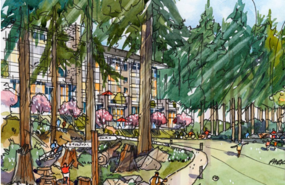
If it's approved, it will be comprised of about 3,300 new homes, as well as commercial and mixed-use spaces.
A draft of the terms of reference is to be presented to Anmore village council at its meeting Tuesday, March 19.
Icona’s president and CEO, Greg Moore, said in a letter to council in February that the process of preparing the plan could jeopardize its development proposal for the 150-acre property by delaying progress on it for more than a year.
But the village’s manager of development services, Chris Boit, said in a report the document will “form a solid foundation for moving forward with the process of considering the OCP amendment application.”
The terms of reference, prepared by Placemark Design and Development, anticipates a four-phase approach with opportunities for community engagement like online updates, group meetings, open houses and surveys along the way.
The first phase includes detailed technical studies of the impact the proposed development could have on the surrounding environment, possible geotechnical hazards in the area like slope instabilities or rockfall hazards and assessment of possible archeological sites and how they might be managed during construction.
As well, the developer will have to analyze the village’s market for retail and commercial spaces, identify the neighourhood’s need for civic facilities like a community centre and parks, detail its network of streets, cycling and pedestrian routes and potential future transit stops and connections.
As assessment of the new neighbourhood’s impact on the existing road network and potential future improvements will also be required along with plans to connect it to regional water, sanitary and drainage networks as well as utilities.
In the second phase, the proponent will develop several possible land use scenarios including density and population projections, along with associated neighbourhood amenities, to be presented to council. It will also have to work with School District 43 to determine future school requirements.
Based on feedback and discussion from the second phase consultation, the proponent will then prepare a preferred plan for its project as well as draft analyses of its various technical studies and assessments for the plan’s third phase. It will also include an analysis of impacts to Anmore’s property taxes, village budget and costs.
The fourth phase will present a final neighbourhood plan along with finalized technical and financial studies to village staff for consideration by council.
In addition to required official community plan and zoning bylaw amendments, Anmore will also have to apply to update Metro Vancouver’s regional context statement to redesignate the Anmore South neighbourhood from rural to general urban. That would allow it to be connected to regional sewer and water services.


