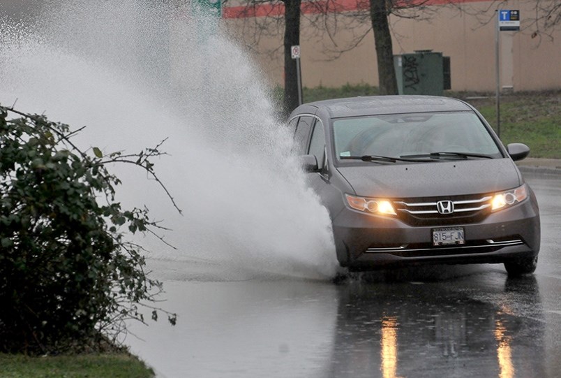
The Tri-Cities forecast this week calls for a significant rainfall after long stretch of warm, dry weather.
Last month was Metro Vancouver’s fifth driest March on record, having only received less than a third of its average rainfall, according to Environment Canada meteorologist Carmen Hart.
“March was an extremely dry month across the province, and Metro Vancouver only received eight days of rainfall; the region usually sees around 17.8 days of rain,” she said.
But that dry spell is set to end late Tuesday evening as rainfall settles over Metro Vancouver.
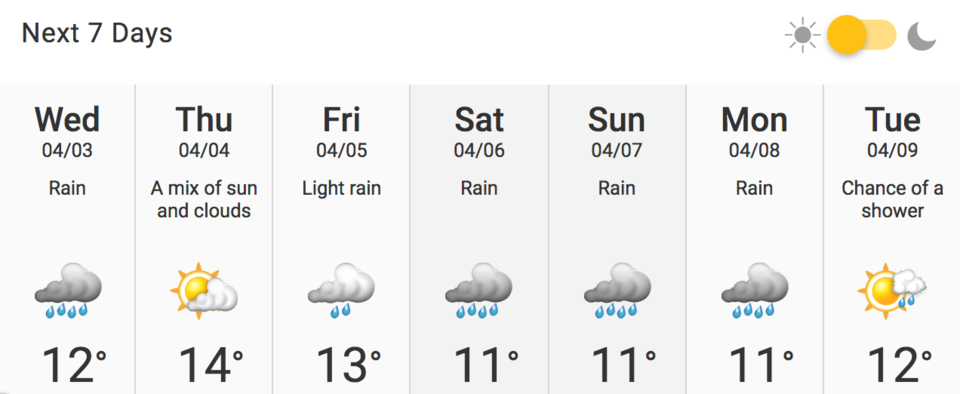
On Wednesday, the Weather Network predicts between 15 and 20 mm of rainfall for the Tri-Cities, with daytime temperatures dipping down to 12 C.
Thursday is expected to clear up with only a 30 per cent chance of precipitation.
By Friday, the rain will be back and is predicted to continue all the way through the weekend and into Monday with highs hovering around 11 C.
Rainfall is predicted to peak on Saturday when the Weather Network predicts between 30 and 40 mm of rain.
This all comes after a very dry March.
On Wednesday, March 20, a jaw-dropping 48 weather records were broken across B.C. What’s more, some areas saw soaring highs of nearly 26°C.
For example, the Agassiz Area broke its old record of 21.7°C set in 1915 with a summery high of 25.8°C. Likewise, the Squamish Area broke its old record of 21°C set in 1999 with a toasty 25.9°C daily high.
— with files from Elana Shepert


