The Shoreline Trail upgrade project is halfway to completion.
It took roughly eight months for Port Moody crews to replace a pair of old sanitary sewers along the six-kilometre loop trail, stretching from the 3200-block of Murray Street near the railroad track to Old Orchard Park (630 Alderside Rd.).
All that's left is to widen, repave and add new amenities to the popular recreation trail, Port Moody spokesperson Natasha Vander Wal explained in a news release Tuesday (March 7).
And a replacement for the current bridge over Noons Creek is also part of those plans — set to be completed by the fall.
As well, Vander Wal said additional upgrades include:
- Widening of parts of the pathway
- Installing new asphalt surface
- Improved drainage
- New benches, and wayfinding and interpretive signs
- Improvements to environmental and riparian areas
Open for two months
The second and final phase of the project is scheduled to start in May with a goal of fully reopening for public use by December.
That means spring walkers, hikers, bikers and dog-walkers alike can use Shoreline Trail for the next two months before the Phase One detour takes effect once again for the remainder of the year.
"The city would like to thank residents and visitors for their patience and understanding during the intermittent closures," said Vander Wal.
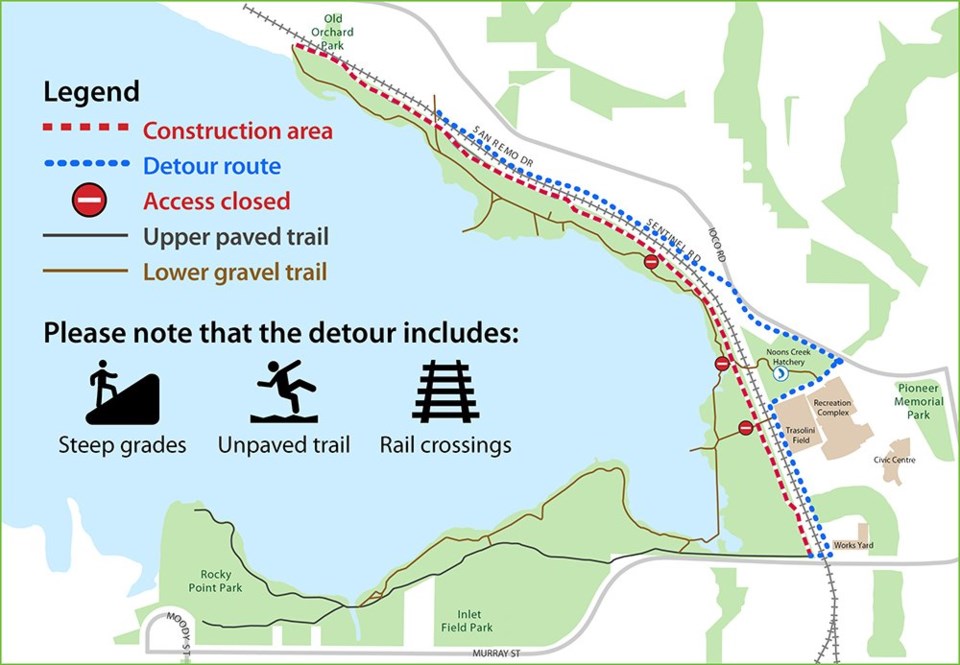
The detour that was in place during the sanitary sewer upgrades will be back in effect for the pathway construction.
Signs will be posted to direct trail users behind Trasolini Field and the Port Moody Recreation Complex to Ioco Road, then along Sentinel Road to San Remo Drive connecting to the trail south of Old Orchard.
The opposite will apply to southbound walkers.
The city advises visitors and residents to take precaution when using the temporary route as it includes unpaved trail, steep upgrades and railway crossings.
For more information about the project, you can visit the City of Port Moody's website.