Cycling advocates say they have a simple solution to the annual summer traffic congestion problems around Belcarra Regional Park.
But the chair of Port Moody’s transportation committee says easing the crush of vehicles that descend upon the park whenever the weather gets hot is more complicated than just throwing up some bollards and slapping down paint to create a separated lane for cyclists and pedestrians.
Coun. Steve Milani said while vehicle traffic from visitors to the park at peak summer times has long been an issue, increasing demand from a growing population for access to its hiking trails, sandy beach and cooling waters has made managing traffic along Bedwell Bay Road and First Avenue more challenging in recent years.
That was especially true during the recent heat wave in late June.
“Everyone wanted to cool off in the lakes,” Milani said, adding officers from Port Moody Police and bylaw enforcement couldn’t keep ahead of the vehicles parking illegally along the roadside.
Colleen MacDonald, a Belcarra resident who’s authored several guidebooks for family-friendly rides around the Lower Mainland and the Okanagan, said one way to keep people from driving cars to the park would be to provide protected space for cyclists and pedestrians so they could safely get to the park after the already-existing Shoreline Trail ends at April Road.
She said on busy days, many families are already making the long walk from their car parked at the Ioco townsite, many of them hauling inflatable boats, coolers and other beach supplies.
“It is so dangerous,” she said of the de facto narrow passageway between cars parked on the shoulders and passing traffic.
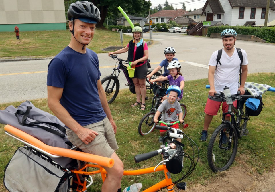
Andrew Hartline, a cycling enthusiast who travels everywhere by pedal power, said he’s pretty much given up heading to Sasamat Lake with his four- and eight-year-old children perched astride his bright orange cargo bike.
“It’s just way too much for a normal person to handle,” he said, adding several blind corners along the route make the journey especially harrowing.
MacDonald said cyclists have been seeking a safer route to Belcarra for years, and it’s been part of Metro Vancouver’s transportation plan since 1997, but with the growing congestion in the area and more people cycling, it’s time to put that plan into action.
Milani said Port Moody is acutely aware of the growing need for safe corridors to accommodate cycling and walking. In fact, one of the main goals of the city’s master transportation plan is to double the number of trips residents make using active transportation and transit, from 20% to 40%.
“We need people to get out of their cars,” he said. “A proper MUP [Multi-use Path] would help.”
Milani said city council recently authorized staff to undertake a study in partnership with Metro Vancouver to review options for a separated MUP or bike/walking corridor to Belcarra. But it likely won’t be completed until late this year at the earliest, and any recommendations would have to budgeted in future years.
In the meantime, Milani said a temporary solution of creating a separated lane marked by bollards and paint is complicated by the narrow roadway that would require sections to be widened, relocation of existing barriers and even culverting of ditches. And that would be expensive.
“Grant funding would need to be sought out to help fund a project of this magnitude.”
MacDonald acknowledges it’s “a big ask.” Long-term, the ideal solution would be a path that winds through the historic Ioco townsite, that already has quiet roads with easy gradients in place away from the busy thoroughfare.
But that would require cooperation from the townsite’s owners, Gillic Global Development Management Inc. and Imperial Oil, further complicating a solution.
In the meantime, Milani said the city will work to make it safer for pedestrians and cyclists to get to the park, including added enforcement of parking regulations and the installation of more concrete barriers in key locations.


