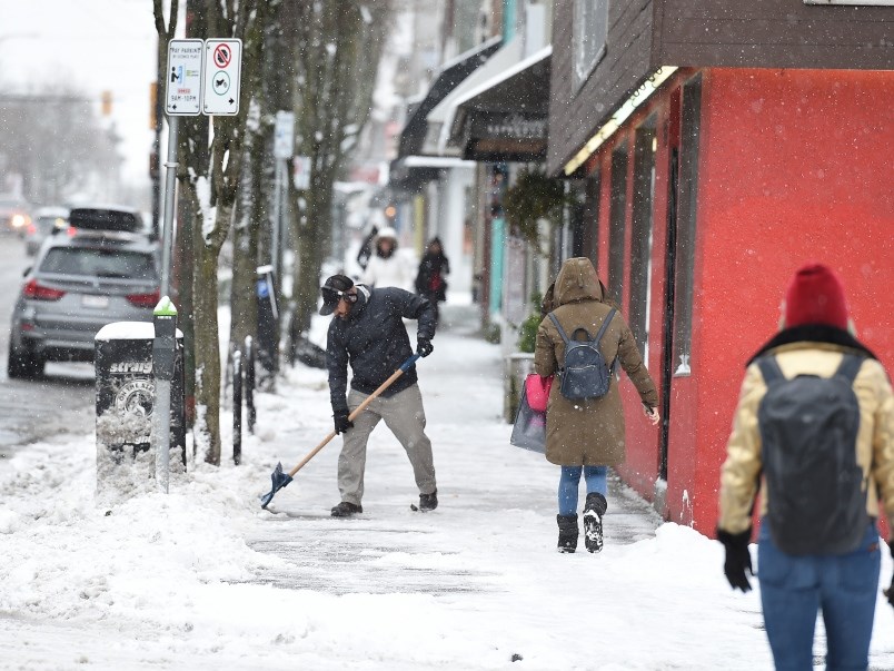
Environment Canada has issued a special weather statement warning of possible snow Tuesday, beginning in the morning, making for what could be a slushy commute to and from work.
The city of Port Moody is asking residents via Twitter to keep their cars off the street so snow plows can get through.
Anywhere from 5 to 20 cm of heavy, wet snow is expected, according to the Environment Canada website.
TransLink is also reminding commuters to build extra time into their commute but has a game plan if conditions are severe, including adding more staff, cars and communication.
Meanwhile, Environmental Canada is predicting a significant amount of snow in some areas.
“Snowfall amounts will vary significantly across the region. The air will be cool but not truly Arctic, so snowfall amounts will vary with proximity to the water, elevation and intensity of precipitation,” Environment Canada reports.
The northeast region of Metro Vancouver, including the Tri-Cities, is expected to see some significant snow, and the snowfall could persist the longest, until Tuesday night or Wednesday morning.
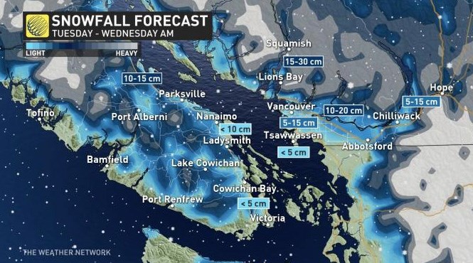
In some areas in the Lower Mainland, likely closer to the water, as well as on Vancouver island, snow is likely to turn to rain as the temperatures warm.
The expected deluge comes as Tri-City residents clean up from torrential rains on Friday that caused flooding, knocked out power and downed trees.
The Weather Network is also predicting a “high-impact” snow event for the Lower Mainland.
It states that this event will be ”fairly similar to the storm on Jan. 10, which featured approximately 8 cm of snow for Vancouver airport and 20 cm for Coquitlam.”
Environment Canada has issued a special weather statement warning of possible snow tomorrow.
— City of Port Moody (@CityofPoMo) February 3, 2020
if you can, please keep your vehicles off the street so our plows can get through & please keep your sidewalks clear. More information at https://t.co/ZEIbiE5nXF #portmoody pic.twitter.com/FGANVJ7uGj


