It seemed like four seasons arrived then left suddenly over the lunch hour in the Tri-Cities.
Around noon today (April 12), bite-sized hail began to drop from the sky outside our Tri-City News offices (3430 Brighton Ave.) along the Coquitlam-Burnaby border and built up to look like snow in several parts of the neighbourhood.
But then, the actual white stuff showed up.
Mother Nature began to sprinkle wet snow for a short period of time to add a bit of slickness to the roads, train tracks and sidewalks.
Not long after, the sun peered through the dark clouds and seemingly melted almost everything.
Environment Canada issued a snowfall warning for the Tri-Cities yesterday afternoon (April 11) for this morning, and some residents at higher elevations in the region and neighbouring communities witnessed the split shift in weather before 8 a.m.
"The south coast remains under the influence of a cold and unstable air mass," read the national service's warning, which has since ended.
"The snowfall accumulation will be highly variable and dependent on precipitation rate, and surface and air temperature."
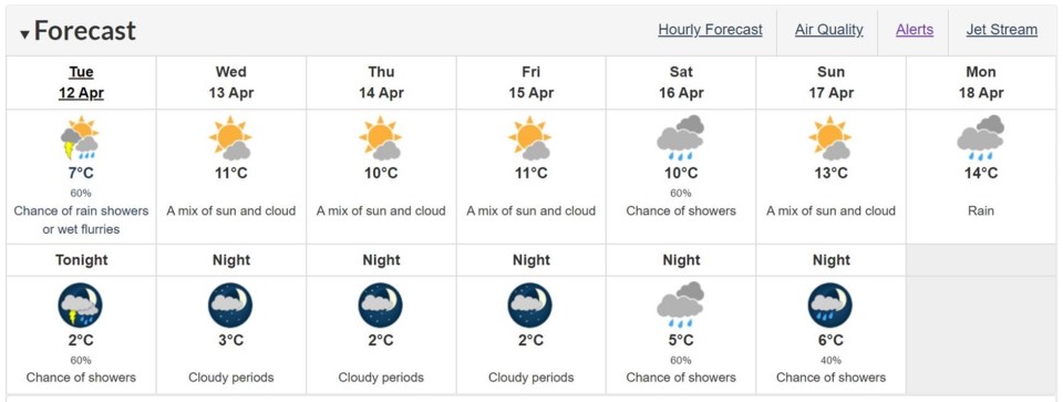
There's a risk of thunderstorms later today coupled with winds gusting up to 20 km/h and a 60 per cent chance of showers for the evening.
According to the latest seven-day forecast, the rest of the week is showing a mix of sun and clouds with temperatures expected to stay above 10 C through until the weekend.